
Which GPS for Hill Walking?
Choosing a GPS (for Hill Walking)
At Peak Navigation Courses we run sessions to help people get to grips with their GPS most weeks. We are often asked which GPS device is the best
or which GPS should I buy? Sometimes we are challenged by people arguing that
their smart phone is as good or better than a dedicated GPS device. We always
try to give an unbiased view, and in this blog we shall attempt just that,
however, our experience is limited to Garmin, SatMap and ViewRanger.
The Smart Phone / View Ranger.
I’ve had View Ranger on my Phone and
smart phone for many years and though I find its functions as good (and possibly
even better) as any dedicated GPS device, I’d never rely on it when the chips
are down. Most mobile phones have poor battery life and don’t run View Ranger
for more than 8 hours. Phone’s are not usually shock proof, dust proof or water
resistant. Great in good conditions. If you do decide to go for this option, invest in a good quality case and extra battery pack, so you have the resources to summon help if you need to.
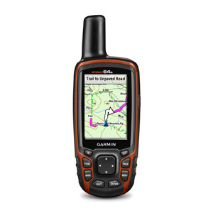
GPS Devices.
You need to make a choice: firstly do
you want one that has OS mapping installed or one with out? Secondly if you
have chosen to opt for one with OS mapping, do you want one that is touch
screen or one that you work by pressing buttons?
If you are a competent navigator
perhaps you only need a device in your rucksack for emergencies. If this is the
case and you only want a grid reference to confirm where you are and the
ability to do a “take me to” function then you only need to go for a bottom of
the range model. For this choice I’d go for the new Garmin eTrex10. A
fantastic device at entry level, and so much better than the EtrexH that it
replaced. I used to fall into this category and carried a basic eTrex for years
only occasionally using it. However the more I’ve used GPS over the years, the
more I appreciate being shown where I am and being able to mark a spot on the
map (on the screen) and the device pointing the way in seconds. Things have
really moved on in recent years and the entry level eTrex with monochrome
screen is so dowdy and slow to punch grid references into whilst out in the
field.
If you want a device with OS mapping,
you now need to decide whether you want a touch screen model or one that
requires you to press buttons to make it work. I can definitely use the whole
Garmin range using winter gloves though it takes a bit of getting used to so
don’t be put off using a touch screen for this reason.
You can attend one of our half dayGPS training sessions and try out a range of devices, touch screen or buttons,
big and small (and some in between).
Here
are some facts about sizes and battery life:

Of the models listed above, only the
eTrex 10 does not have the capacity to use additional mapping.
A lot of retailers will sell GPS
devices as a “bundle” with a mapping chip.
At the time of writing GO Outdoors
have an offer on most of their GPS devices e.g.:
Montana 600 (becoming obsolete) with
full 1:50 U.K. mapping £299
Oregon 650 with
full 1:50 U.K. mapping £369
Etrex 25 (touch) from £199 with full
1:50 U.K. mapping
Etrex 20, £145 with full 1:50 U.K.
mapping
Opinions!
Touch Screens:
I personally believe that the Montana
is too big and heavy and the Dakota is too old a model with not enough memory.
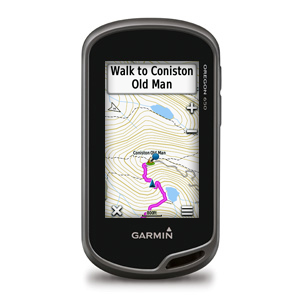
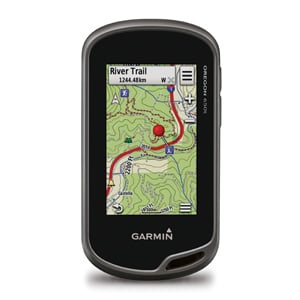
So given a choice between the Oregon 650’s and the eTrex Touches I would go for the slightly bigger screen of the 650’s, and if you can afford it go for the 650t a great device.
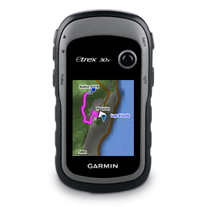
If you do decide on an eTex Touch, the 35 is the better model having the ability to transfer data wirelessly and with a barometric altimeter.
So given a choice between the Oregon 650’s and the eTrex Touches I would go for the slightly bigger screen of the 650’s, and if you can afford it go for the 650t a great device.
If you do decide on an eTex Touch, the 35 is the better model having the ability to transfer data wirelessly and with a barometric altimeter.
Button Devices:
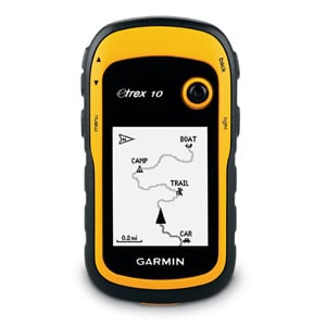
If all you want from your device is a grid reference to confirm you position then obviously the Etrex 10 is the way to go.
If you are wanting a device with
mapping, I personally believe that the screen on the eTrex is too small. That said I do need reading glasses and
prefer large print!
I love the way the SatMap has a red circle around your position on the Map but it’s direction pointer when navigating is all over the place.
Conversely I love the navigation compass page on the Garmins but hate the triangle that obscures your position on the map! One thing I would say is that they are very different devices and some people find the “logic” of the SatMap less intuitive making it more difficult to use, you also have to rely on their proprietary mapping, which makes them much more expensive than using free open source maps.
In terms of robustness, there is no
doubt that the Garmins are sturdier than the SatMap which requires an
additional cover (purchase) to bring it up to the same standard of water
resistance of the Garmins.
In the end it’s a matter of personal
choice. Any of these models will do the job, though we now much prefer the Garmin models. Read the manufacturers
specifications, which are available online. Once you have decided whether you
want mapping or not, either come on one of our courses to try them out or go to
a reputable retailer and try them out. Don’t be swayed by pushy sales
staff expressing an opinion, go for the one that you find easy or straightforward to use.
If after reading this you still have
questions about which device, feel free to email us at Peak Navigation Courses.
Jane and Mike have been running Peak Navigation Courses since 2004. They are both qualified International Mountain Leaders regularly leading walking holidays both in the U.K. and overseas.
Jane and Mike have been running Peak Navigation Courses since 2004. They are both qualified International Mountain Leaders regularly leading walking holidays both in the U.K. and overseas.


